The Anfield Project represents one of Liverpool’s most mature, complex, and structurally significant spatial regeneration programmes. Originally launched as a strategic alliance in 2014, anchored by Liverpool City Council, Liverpool Football Club (LFC), and Your Housing Group (YHG), the scheme has evolved into a £300 million masterplan. As of May 2026, the programme has successfully transitioned from its highly visible, capital-intensive early phases, which focused on the physical expansion of Anfield Stadium and the volume delivery of 1,200 new and refurbished homes, into a granular, neighbourhood-level placemaking phase aimed at stabilising the local high street and civic infrastructure.
My central judgement is that the Anfield Project has fundamentally de-risked the L4 postcode district from a state of severe housing market failure to a functional, regenerating neighbourhood. However, the execution profile has now shifted. The immediate focus is the £4 million to £5 million investment in Walton Breck Road, where major highway, traffic-calming, and public realm upgrades commenced in May 2026. These physical works, designed by AECOM, are scheduled to complete by December 2026. Simultaneously, the strategic core of the project is pivoting towards the 2.5-acre Anfield Square site, a cleared brownfield plot adjacent to the stadium, which is currently undergoing a detailed development brief process led by property consultants JLL.
For the local property market, the L4 postcode district currently presents a median completed sales price of £156,000, based on February 2026 transaction data. This sits materially below the Liverpool local authority average of £177,000, indicating a micro-market that remains relatively accessible but is undergoing substantial structural improvement. The injection of high-quality public realm, improved pedestrian safety, and new commercial spaces on Walton Breck Road is likely to consolidate the appeal of the existing housing stock, rather than acting as a sudden catalyst for extreme price inflation.
The headline public offer delivered to date is substantial. The safest current reading of the delivered scheme includes: 600 new-build homes, 600 comprehensively refurbished terraced properties, the revitalisation of the Grade II* listed Stanley Park, a new school, and significant stadium expansions bringing capacity to over 61,000. The future pipeline includes the residential redevelopment of the former Four Oaks school site and Hodder Street, alongside the comprehensive mixed-use redevelopment of Anfield Square. Furthermore, Anfield forms a central pillar of a collaborative Liverpool City Region bid for formal "New Town" status, which seeks to deliver up to 10,000 homes across North Liverpool and Bootle over the coming decade.
Investors should view Anfield through a lens of long-term civic stabilisation and sustained rental demand, rather than speculative capital growth. The primary execution risks are no longer related to whether the core partners are committed to the area, but rather how successfully the local authority can secure a high-calibre, private-sector development partner for Anfield Square in a high-interest-rate environment, and how effectively the local transport infrastructure can balance the competing demands of a global 61,000-capacity event venue and a growing, permanent residential community.
Project overview
The Anfield Project sits within the formal planning boundaries of the Anfield Spatial Regeneration Framework (SRF), officially adopted by Liverpool City Council on 25 April 2014. This supplementary planning document was created to guide sustainable development, heritage conservation, and economic growth in the L4 district. The project emerged out of necessity, designed to reverse decades of acute population decline, housing market failure, and the controversial legacy of the Housing Market Renewal (HMR) initiative, which left vast swathes of Victorian terraced streets boarded up and structurally decaying in the early 2000s.
The masterplan operates on a "triple-helix" partnership model. Liverpool City Council provides the statutory weight for land assembly, compulsory purchase where necessary, and masterplan coordination; Your Housing Group (YHG) manages the social, affordable, and refurbishment housing delivery alongside private developer partners; and Liverpool FC drives the commercial and visitor-economy elements through its stadium expansions and associated retail footprint.
The strongest currently available public description of the Anfield Project's scope and achievements is summarised below, drawing strictly from official council, combined authority, and partnership documents.
| Category | Best-supported current position |
|---|---|
| Programme Scale | Approaching £300 million total public and private investment since 2014. |
| Housing Delivery (To Date) | 600 new-build homes (mixed tenure) and 600 comprehensively refurbished terraced homes (Anfield Village/Rockfield areas). |
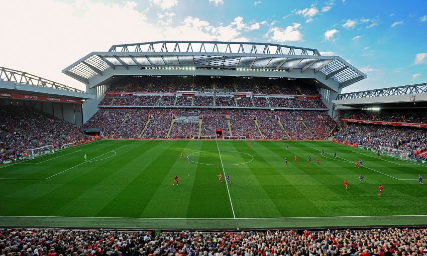
| Stadium Expansion | £120 million new Main Stand (2016) and subsequent Anfield Road Stand expansion, bringing capacity to over 61,000. |
| Live Infrastructure (2026) | £4m-£5m Walton Breck Road and adjacent streets highway/public realm upgrade (Commenced May 2026, completion expected December 2026). |
| Primary Future Sites | Anfield Square (2.5 acres/1 hectare), Hodder Street, former Four Oaks school site. |
| Anfield Square Vision | A mixed-use scheme integrating leisure, entertainment, employment, and community F&B uses; specific hotel proposals previously rejected in favour of a broader mix. |
| Public Realm / Heritage | Revitalisation of the Grade II* listed Stanley Park; upcoming "Red Walk" active travel connection linking to wider North Liverpool regeneration. |
| Social Infrastructure | Delivery of a new school, community centres, and integration into the city's expanding Family Hub network. |
A critical turning point in the project's governance and delivery velocity occurred in March 2025, when Liverpool City Council paid £381,441.92 to Your Housing Group to acquire the remaining 18 freeholds and leaseholds on the Anfield Square site. This strategic buyout consolidated the entire 2.5-acre site under single council ownership. Analytically, this is a highly significant de-risking event. Fragmented land ownership is historically the primary barrier to brownfield regeneration in the UK; by consolidating the title, the council removed complex joint-venture legalities, allowing the local authority to market the site to developers with a clean title and strict alignment to the SRF vision.
The project is also notable for its integration of alternative, community-led regeneration models. The Homebaked Community Land Trust (CLT) has been actively involved in refurbishing Edwardian terraces on Oakfield Road. This ensures that grassroots stakeholders retain a tangible, equity-based stake in the neighbourhood's physical evolution, mitigating the traditional gentrification risks associated with large-scale, top-down sports-anchored regeneration.
Official scheme details and delivery timeline
The Anfield Project is inherently phased. With the bulk of the heavy residential construction and major stadium engineering in the immediate vicinity now complete, the programme has fractured into specific, targeted sub-projects focusing on civic space, high-street functionality, and gap-site infill.
Walton Breck Road Upgrades (Active Phase)
Following a cabinet approval in February 2026, a £4 million to £5 million highway and public realm contract was awarded, with physical works commencing in May 2026. The works are designed by AECOM and cover the primary arterial route of Walton Breck Road, alongside Oakfield Road, Pulford Street, Back Rockfield Road, and Gilman Street.
The official specification is highly detailed and focuses on transforming a vehicle-dominated thoroughfare into a pedestrian-prioritised environment. Interventions include:
- A formal reduction of the speed limit from 30mph to 20mph between the junctions of Blessington Road and Kemp Avenue.
- The installation of a new mini-roundabout at the critical junction of Walton Breck Road and Oakfield Road to calm traffic flow.
- The closure of vehicle access to Back Rockfield Road from Pulford Street, creating a safer pedestrian zone with a dedicated vehicle turnaround area.
- Widened footpaths, high-quality carriageway resurfacing, tactile surfacing for visual impairments, and modernised street lighting.
- The rationalisation of on-street car parking, bus stops, and taxi ranks, alongside the installation of underground "superbins" and extensive new tree planting to visually soften the urban environment.
Anfield Square (Strategic Pipeline)
This 1-hectare (2.5-acre) site sits in the immediate shadow of the Kop stand. It was historically populated by around 150 dilapidated terraced houses, which were cleared in 2016. In January 2023, the council appointed property consultants JLL, alongside LDA Design and PLACED, to execute a soft market testing exercise and draft a comprehensive development brief.
The council has been highly prescriptive regarding the site's future. Official documents confirm that the local authority explicitly rejected an earlier proposal from LFC to build a standalone hotel, insisting instead on a "best-in-class" mixed-use development that balances matchday commercial viability with everyday community amenities, employment space, and leisure. Following the March 2025 land consolidation, the council stated that an "options analysis" is dictating the long-term future, while "meanwhile uses" (such as temporary pop-ups, community events, or fan zones) are being explored to activate the space in the short term prior to vertical construction.
Housing Infill and Future Phases
While the volume delivery of the initial 1,200 homes is complete, the residential pipeline remains active. Council reports confirm that the former Four Oaks school site and plots on Hodder Street are officially earmarked for the next wave of residential development. Furthermore, earlier phases delivered by Keepmoat Homes and Priority Space saw the construction of 85 two-, three-, and four-bedroom houses across remodelled streets including Viceroy Street, Vanguard Street, and Vyrnwy Street. The council is currently preparing to engage with the market to bring forward new homes on the remaining infill plots, signaling a continuation of housing supply expansion in the L4 district.
Planning, infrastructure and transport context
The planning and legal framework for the area is strictly governed by the Anfield Spatial Regeneration Framework (SRF). This document, adopted in 2014, provides the material planning weight required to enforce high design standards, prevent piecemeal low-quality development, and justify land assembly. It is the definitive document against which all future planning applications in the district will be judged.
Transport and connectivity represent the most acute operational challenges in Anfield. The district is relatively isolated from the Merseyrail underground network, making it heavily reliant on the surface road network, specifically the A5089 (Walton Breck Road) and the broader A580 (East Lancashire Road) corridor.
Highway and Active Travel Interventions
The May 2026 Walton Breck Road upgrades are fundamentally about pedestrian safety and traffic calming. By narrowing carriageways and reducing the speed limit to 20mph, the council is attempting to stitch the monolithic stadium footprint back into the fine-grain residential fabric of the high street. Furthermore, Liverpool City Council is actively developing active travel corridors under a wider city cycling project. Route 4 (East Lancs - Townsend - Breck Road - City Centre) is designed to improve non-vehicular access into North Liverpool, directly supporting the SRF's sustainability goals by reducing car dependence.
Bus Infrastructure and Matchday Logistics
Merseytravel operates high-frequency public transport through the area, notably the Route 17 network (including 17A and 17X), which links Queen Square Bus Station in the city centre to Walton Breck Road, Aintree University Hospital, and Kirkby. Operational management of this network is highly complex: on matchdays, Walton Breck Road is subjected to hard closures 90 minutes prior to kick-off, reopens briefly during the match, and closes again for 45 minutes post-match to safely disperse tens of thousands of pedestrians.
The ongoing physical upgrades are forcing a tangible re-evaluation of local street trading. Council committee documents from late 2025 indicate that several of the 50 licensed matchday traders on Walton Breck Road and intersecting streets may have their permits revoked or be forced to relocate. Specific conflicts include traders on the Skerries Road junction (due to new planters) and Townson Street (due to new resident-only parking schemes). This micro-level friction highlights the council's broader strategic prioritisation of permanent civic realm improvements and resident amenity over legacy, ad-hoc matchday commercial infrastructure.
Local economy implications
The economic profile of Anfield is heavily bifurcated between the steady, year-round residential economy and the highly concentrated, cyclical matchday visitor economy.
On a macro level, the £300 million investment to date has supported significant construction and supply-chain employment. While early phases were dominated by volume housebuilders and Tier 1 stadium contractors, the current phase supports civil engineering, highways maintenance, and urban design roles.
The long-term commercial capacity is anchored by the new high street strategy. LFC's own flagship retail store on Walton Breck Road, which expanded the club's retail footprint by four times to 19,500 sq ft and created 60 jobs, acts as a primary commercial anchor. However, the wider objective of the Anfield Square site and the Walton Breck Road redevelopment is to capture and retain more visitor spend within the immediate L4 boundary. Currently, a significant portion of matchday revenue leaks back into the city centre's hospitality sector post-match. A "best-in-class" food, beverage, and leisure offer at Anfield Square would retain this capital locally, supporting sustained, year-round job creation in the hospitality and service sectors, insulating the area from the seasonality of the football calendar.
Furthermore, Anfield's economic future is intrinsically tied to the wider North Liverpool corridor. In 2025, a coalition including Liverpool City Council and Sefton Council submitted a formal bid to the UK government seeking New Town status for Anfield, Bootle, Everton, and Kirkdale. If progressed, this 10-year "whole place" transformation scheme aims to unlock funding for up to 10,000 new homes, physically and economically linking the legacy site of Goodison Park, the new waterfront stadium at Bramley-Moore Dock, the £20m Bootle New Strand development, and the Anfield SRF into a single, cohesive economic zone.
Housing market implications
The L4 housing market provides a distinct profile within the wider Liverpool context. Based on local property evidence from February 2026, the median completed sales price in the L4 district sits at £156,000. This is approximately 11.8% below the Liverpool local authority average of £177,000.
This pricing baseline indicates that Anfield remains an accessible market for both owner-occupiers and investors, avoiding the premium pricing associated with the city centre or the South Liverpool suburbs. The delivery of 600 new-build properties by Keepmoat and Priority Space, alongside 600 comprehensive back-to-brick refurbishments by Your Housing Group, has already materially altered the composition of the local housing stock. The "Anfield Village" refurbishments were particularly impactful, involving the structural combination of smaller traditional terraced houses to create larger, modern family homes, while simultaneously introducing £2 million worth of tree-lined pedestrian areas, private side gardens, and secure communal refuse stores to eliminate the blight of restricted-space alleyways.
The housing market impact of the current phase (the Walton Breck Road works and the eventual delivery of Anfield Square) should be viewed cautiously as a long-term stabiliser rather than an immediate price multiplier. The primary economic effect of an improved high street, traffic calming, and high-quality public realm is to reduce the "neighbourhood discount", the penalty applied to property values due to poor surrounding environments, dereliction, or anti-social behaviour.
As the public realm improves and commercial amenities arrive, the gap between L4's £156,000 median and the city average of £177,000 is likely to narrow gradually. However, because the council and its housing association partners actively manage land release (such as the upcoming Four Oaks and Hodder Street sites) with a focus on affordable and mixed-tenure housing, local supply will continue to expand alongside demand. This managed supply pipeline should prevent artificial, unsustainable price spikes, creating a healthier, steadier trajectory for capital preservation.
Rental market implications
Rental demand in the Anfield area is robust, driven by several overlapping, non-cyclical demographics:
- Key workers and medical staff: Proximity to primary transport corridors (specifically the Route 17 bus network) provides direct, rapid access to Aintree University Hospital, creating sustained demand from healthcare professionals.
- Local employment: Staff associated with stadium operations, the expanding local retail footprint, and nearby educational and civic services.
- City centre displacement: As central Liverpool and the Knowledge Quarter continue to densify with purpose-built student accommodation (PBSA) and premium Build-to-Rent (BTR) schemes, accessible peripheral districts like L4 capture mature tenants and families seeking larger floorplates, gardens, or lower overall rent burdens.
The rental market in L4 is predominantly composed of traditional terraced stock and newer housing association or build-to-sell stock from recent regeneration phases. The ongoing infrastructure works present a highly positive scenario for rental demand. A high street that is safer, greener, and equipped with modern amenities (such as the proposed Anfield Square leisure uses) materially improves tenant retention. Properties within immediate walking distance of the improved Walton Breck Road pedestrian zones are likely to see reduced void periods and lower tenant turnover.
However, investors should base their underwriting on current market realities. The area does not command the high-density premium seen in waterfront districts like Central Docks or Princes Dock. Rental pricing in L4 should be modeled cautiously, relying on steady, inflation-aligned demographic demand rather than speculative gentrification.
Supply, demographics and demand drivers
The demographic sustainability of Anfield relies heavily on the concurrent delivery of social infrastructure. A sudden influx of residents into 1,200 newly available or refurbished homes requires corresponding civic capacity to prevent the fracturing of the community. The Anfield SRF explicitly addressed this through the delivery of a new school and enhanced community centres early in the programme.
Crucially, Liverpool City Council has integrated Anfield into its expanding network of family support services. By early 2026, the council had rolled out 11 Family Hubs across the city (including facilities in nearby Clubmoor, Fountains, and Everton), providing consolidated support, education, and health services for families with children aged 0-19. The presence of these hubs in North Liverpool acts as a vital demand driver for family-oriented housing, ensuring that the area remains viable for long-term owner-occupiers and stable tenants, rather than suffering the transient population churn often seen in regeneration zones lacking social infrastructure.
The wider demographic context is supportive of continued housing absorption. Liverpool's population, which stood at 494,000 in 2018, is projected to rise to 542,600 by 2033. To accommodate this, the city has a stated ambition to deliver 30,000 new homes by 2030. Anfield is a key spatial component of this delivery strategy.
The area is also benefiting from highly innovative, community-driven supply mechanisms that differentiate it from standard private-sector development. The Homebaked Community Land Trust (CLT) has successfully secured planning to refurbish Edwardian terraces on Oakfield Road, providing affordable housing and commercial space that is explicitly owned and managed by the community. This mixed ecology of supply, combining volume housebuilders, major housing associations, and grassroots land trusts, creates a far more resilient demographic profile than mono-tenure, investor-led developments.
Investor watchpoints and risks
While the Anfield Project is heavily de-risked by its maturity, the £300 million already deployed, and the physical reality of the expanded stadium, several operational and market risks remain critical for due diligence.
Execution Risk on Anfield Square
The 2.5-acre Anfield Square is the linchpin of the neighbourhood's commercial and civic future. While the council now owns the site entirely and JLL is mapping the development brief, securing a private-sector development partner willing to deliver a complex, mixed-use scheme in a challenging, high-interest-rate macroeconomic climate is not guaranteed. If procurement stalls or viability testing fails, the site could languish as a "meanwhile use" fan zone or surface car park for longer than anticipated, delaying the promised high-street integration and suppressing the uplift of surrounding property values.
Matchday Friction
Anfield is, at its core, a dense residential neighbourhood hosting a global sporting venue. A 61,000-capacity stadium generates severe, albeit temporary, stress on local infrastructure. The road closures, parking restrictions, and footfall surges require intense operational management. While the Walton Breck Road upgrades attempt to mitigate this by improving pedestrian flows, residential harmony and tenant satisfaction in properties immediately bordering the stadium footprint will always be subject to the friction of the football calendar. Investors must accept that extreme congestion on 25-30 days of the year is a structural feature of this micro-market.
Infrastructure Disruption
The ongoing Walton Breck Road works (scheduled May to December 2026) involve major carriageway resurfacing, crossing relocations, and utility works. In the short term, this will cause localised disruption, noise, and potential access issues for existing commercial units, bus routes, and residents. Investors assessing immediate acquisitions or scheduling refurbishments in the second half of 2026 should factor in a seven-month window of constrained local accessibility and potential tenant complaints regarding construction noise.
Policy and Governance Shifts
Regeneration on this scale is highly sensitive to local government policy. The appointment of Sophie Bevan as Director of Development and Major Projects in May 2023, alongside a wider restructuring of the council's senior regeneration team, indicates a renewed, professionalised focus on delivery. However, investors must monitor local planning policy, particularly regarding the enforcement of the SRF and the outcome of the "New Town" status bid, which could dramatically alter the funding landscape for the wider North Liverpool area.
Scenario outlook and delivery path
The table below outlines an analytical scenario model for the L4 housing market as the current infrastructure phase beds in. It uses the established £156,000 median baseline for L4 and assumes completion of the Walton Breck Road works by December 2026, followed by the phased delivery of Anfield Square and remaining residential plots into the late 2020s. *This is an analytical projection based on infrastructure absorption, not a financial forecast or a guarantee of returns.*
| Scenario | Infrastructure Execution | Anfield Square Delivery | Likely L4 Price Trajectory Relative to Liverpool Average | Rental Void Impact |
|---|---|---|---|---|
| Pessimistic | Walton Breck Rd delayed; traffic calming fails to alter matchday congestion. | Fails to attract developer; remains temporary surface parking/fan zone. | Remains static at current ~12% discount to city average. | Baseline churn; tenant retention remains average for the city. |
| Central | Highways complete on time (Dec 2026); pedestrian safety demonstrably improved. | Developer appointed 2027; phased mixed-use delivery begins late 2028. | Discount narrows moderately as high-street appeal consolidates existing stock. | Void periods shorten due to improved local amenity provision. |
| Optimistic | Seamless delivery; active travel links fully integrate into city network. | "Best-in-class" anchor tenant secured; scheme acts as a major catalyst for North Liverpool. | L4 premium emerges for high-quality stock; approaches city average. | Strong tenant retention; area becomes a primary choice for hospital/key workers. |
Comparative lessons
Within the context of Liverpool's wider £14.5 billion development pipeline, Anfield provides a stark contrast to waterfront schemes like Liverpool Waters or the city-centre Knowledge Quarter. While Central Docks relies on institutional Build-to-Rent capital and high-density apartments to create a new neighbourhood from scratch, Anfield is an exercise in retrofitting an existing, historic community.
The closest structural comparator is the proposed regeneration of the Goodison Park legacy site and the wider Bootle Strand redevelopment. The lesson from Anfield for these emerging schemes is that anchor institutions (like a football club) can drive initial capital injection, but sustained neighbourhood vitality requires the meticulous, often slow, delivery of unglamorous infrastructure: widened pavements, traffic calming, community land trusts, and family health hubs. Anfield proves that large-scale demolition and rebuild (as seen in the early HMR days) is less effective for community cohesion than the targeted, street-by-street refurbishment and infill strategy currently being executed.
Open questions and limitations
The evidence base is strong enough to judge the Anfield Project as a highly credible, actively delivering regeneration programme. However, several points remain unresolved within the publicly accessible source set.
I could not verify the exact timeline for the publication of the final Anfield Square development brief, nor identify if any specific private-sector developers have been shortlisted following JLL’s soft market testing in 2023. Until a developer is formally appointed and detailed planning is submitted, the exact quantum of commercial space and the specific leisure uses on this pivotal site remain illustrative.
Additionally, I did not obtain a detailed post-implementation review of the Merseytravel routing strategy for the post-2026 period. It remains to be seen exactly how the 20mph zones and the new Oakfield Road mini-roundabout will practically affect the turnaround times of the 17, 17A, and 17X bus services during peak matchday dispersal.
These limitations do not change the main conclusion: Anfield is no longer a speculative bet on future council action. It is an active construction site transitioning from stadium-led megaprojects to the essential, value-consolidating work of high-street placemaking.